
Urban Climate Intelligence Platform
Mumbai's ward-level
heat vulnerability.
Satellite and population data, scored ward by ward.
Every number sourced.
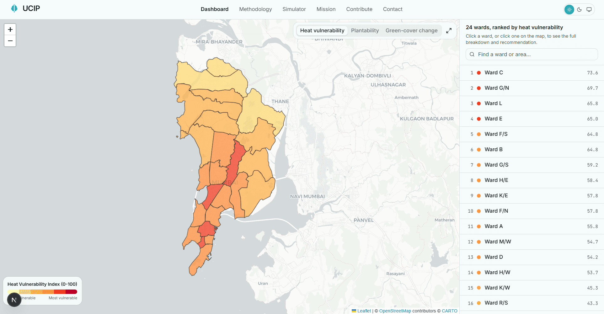
All 24 wards, raised and coloured by heat vulnerability.
Real BMC boundaries, coastline from Natural Earth.
Four ways to look at the city
Heat vulnerability
Every ward gets a score from 0 to 100 combining five things anyone can measure from free satellite and open map data: how hot its surfaces run, how green it is, how crowded, how paved, and how far people are from a hospital. Darker red means more vulnerable.
Heat grid
The same score at the 1 km cell it is measured at, before the cells are averaged into wards. It shows the hot pockets a ward average hides.
Plantability
Not every hot spot should get trees. This layer shows where planting makes ecological sense and where reflective cool roofs are the better fix.
Green-cover change
Satellite comparison against the 2016-17 dry season showing where the city has gained or lost vegetation.
The five most heat-vulnerable wards
From dry-season satellite imagery (1 Nov 2025 to 28 Feb 2026), not hand-picked. Ranks are uncertain; the methodology gives each ward's plausible range.
- 1Ward CHVI 82.6
- 2Ward LHVI 72.0
- 3Ward G/NHVI 71.2
- 4Ward BHVI 70.6
- 5Ward EHVI 69.5
Not another heat map
Most tools stop at a map. UCIP adds the reason behind each ward's score and an ecologically checked option for cooling it.
Rank the wards, explain each score factor by factor, then recommend the right intervention, including rejecting tree-planting where it would backfire. Each step cites its source, and the ones that rest on our own judgement are labelled.
Cited research
The method and the cooling estimates rest on published research
The index method, the plantability filter and the cooling coefficients cite 10 papers, each with a DOI. Where a threshold is our own judgement rather than a paper's, the methodology page says so.
Built in the open
Every scored input is free, open and global: Landsat satellite imagery, ESA WorldCover land cover, WorldPop population rasters and OpenStreetMap, plus the 24-ward boundary file. The method, its weights, and its limitations are documented on the methodology page, including the parts that are proxies or estimates. This is a research prototype, not an official BMC tool.